
Bahila
A porphyry-style molybdenum halo over a magnetite-destructive magnetic anomaly, ringed by skarn and copper veins. Magnetics, IP and surface work define four targets, and a program of more than 5,000 metres of drilling is testing them now.
At a glance
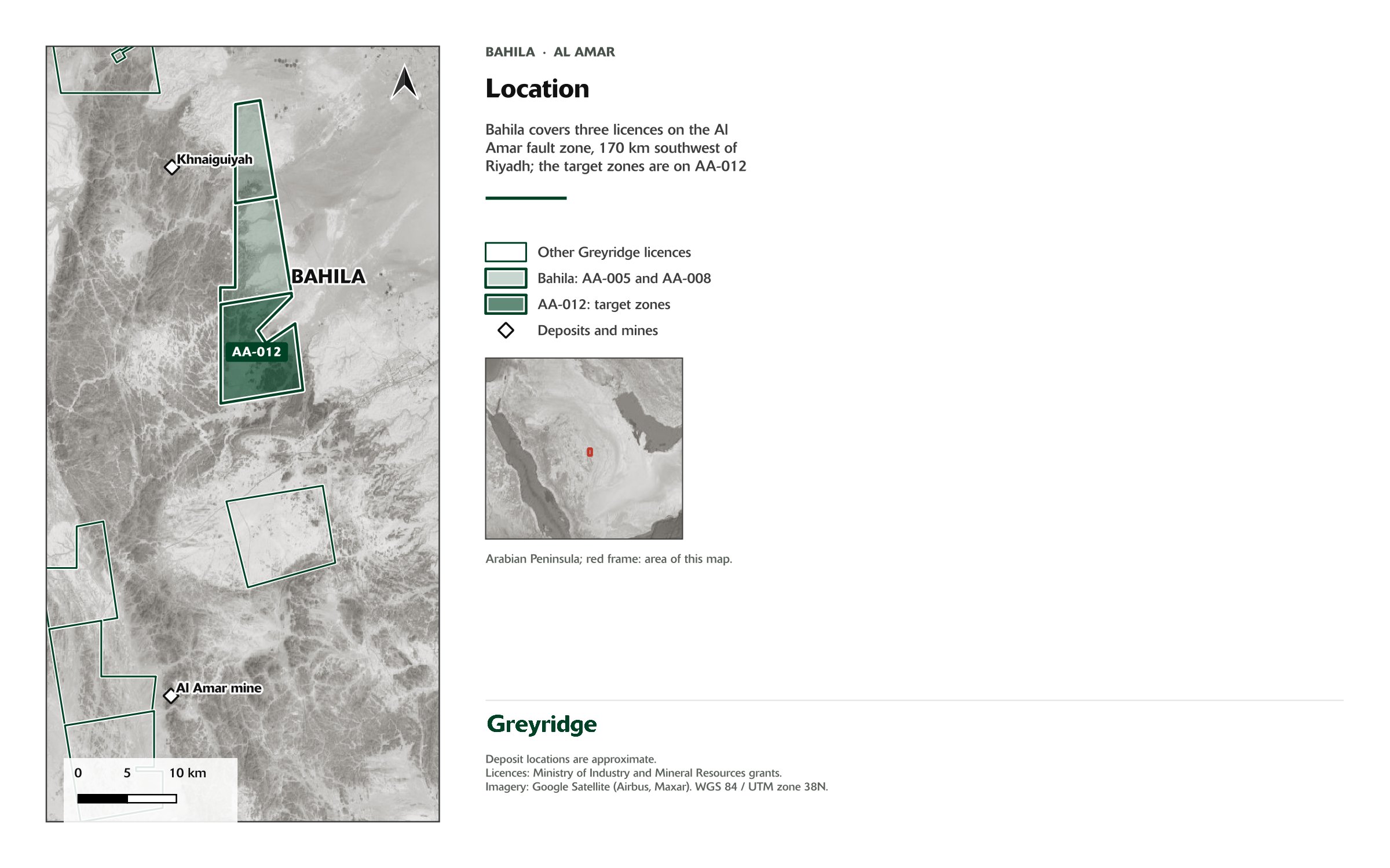
Scale and setting
- Project area
- Al Amar
- Licences
- AA-005, AA-008, AA-012
- Deposit style
- Porphyry copper-molybdenum with peripheral skarn
- Stage
- Drilling underway
- Program
- More than 5,000 m of RC and diamond drilling on one dual-purpose rig
- Contractor
- Golden Compass Mining Company
- Terrane
- Ar Rayn terrane, on the Al Amar Fault Zone
- Neighbours
- Near the Khnaiguiyah zinc-copper project; Ma’aden’s Al Amar mine approximately 35 km to the south
Target
A buried intrusive centre, the working hypothesis
Bahila is the most advanced prospect in the portfolio and the focus of our maiden drill program. The working hypothesis is a concealed, potassic-altered intrusive centre beneath a coincident set of anomalies: a molybdenum-copper geochemical halo at surface, a magnetite-destructive magnetic anomaly, and a chargeable body imaged by induced polarisation.
The prospect lies in the Ar Rayn terrane, interpreted as a Neoproterozoic continental-margin arc analogous to the Andean margin of Chile (Doebrich et al., 2007). Skarn on the northern contact and copper-bearing quartz veins to the south-west are interpreted as peripheral expressions of the same system.

Work completed
From regional data to the drill bit
- Regional government geophysical and geochemical datasets reprocessed and integrated with two seasons of surface mapping and rock-chip sampling.
- Regional airborne magnetics (Saudi Geological Survey), reprocessed, with a three-dimensional magnetic inversion (in3D Geoscience).
- A 104 line-kilometre induced polarisation and resistivity survey over the area of interest (Simcoe Geoscience), with the raw data independently reprocessed and re-inverted by in3D Geoscience. The two models agree on the location of the principal anomalies.
- Geological mapping and sampling along every priority survey line, which identified more than 3 km of quartz-sericite-pyrite alteration along a porphyritic dyke corridor.
- Drill holes designed in the in3D Geoscience 25 m chargeability block model and ranked on the coincidence of geology, geochemistry and geophysics. Reverse circulation drilling underway.
Results
What the work has returned
- A molybdenum halo of approximately 8 km², with 43 rock samples at or above 10 ppm Mo and a peak of 1,450 ppm Mo.
- 16 rock samples above 0.5% Cu, mostly in the Porphyry Zone, to a peak of 1.42% Cu at the Skarn Zone.
- A magnetite-destructive magnetic anomaly approximately 1 km across, coincident with the geochemical core.
- Approximately 1 km of garnet-diopside skarn on the northern contact of the intrusion, with copper and zinc mineralisation at surface.
- 175 chargeability anomalies from the IP survey, 55 of them first priority, on three trends organised around a north-south fault and a northwest-trending fault.
- Four drill targets from the integration of geochemistry, magnetics and IP: the Porphyry Zone, the Skarn Zone, the Central Trend and the Eastern Trend.
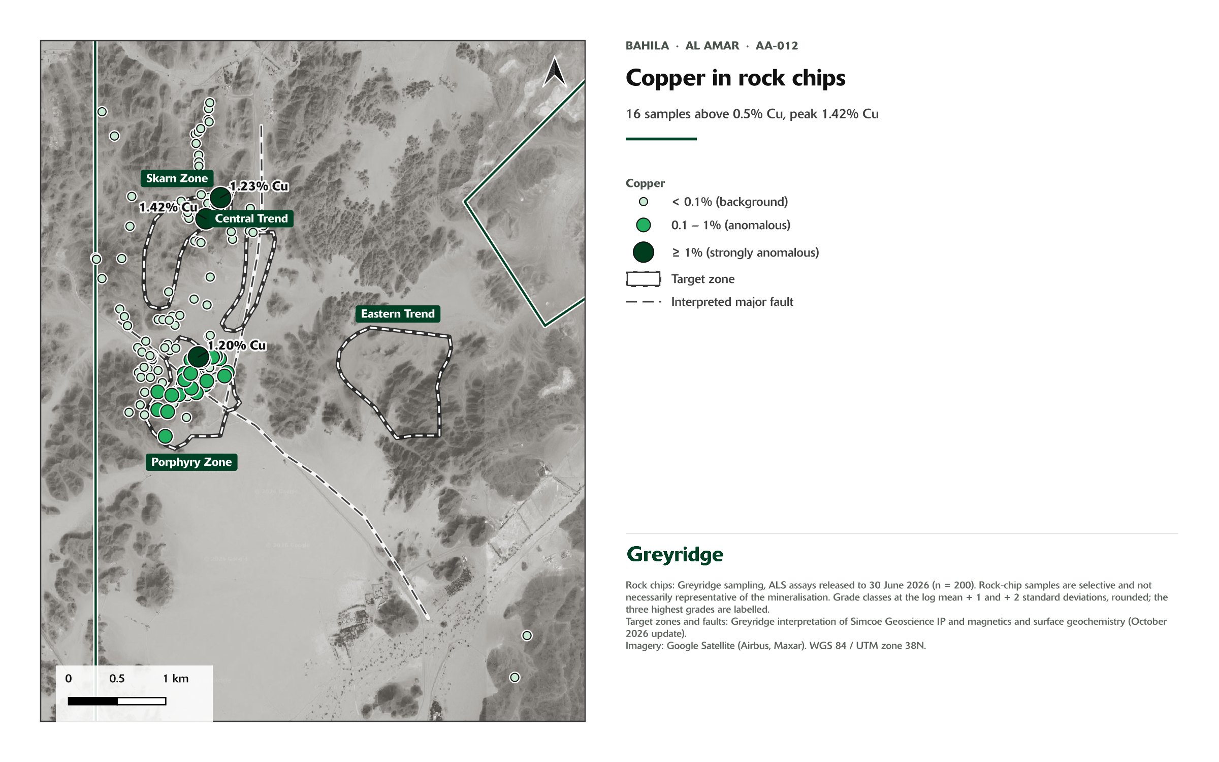
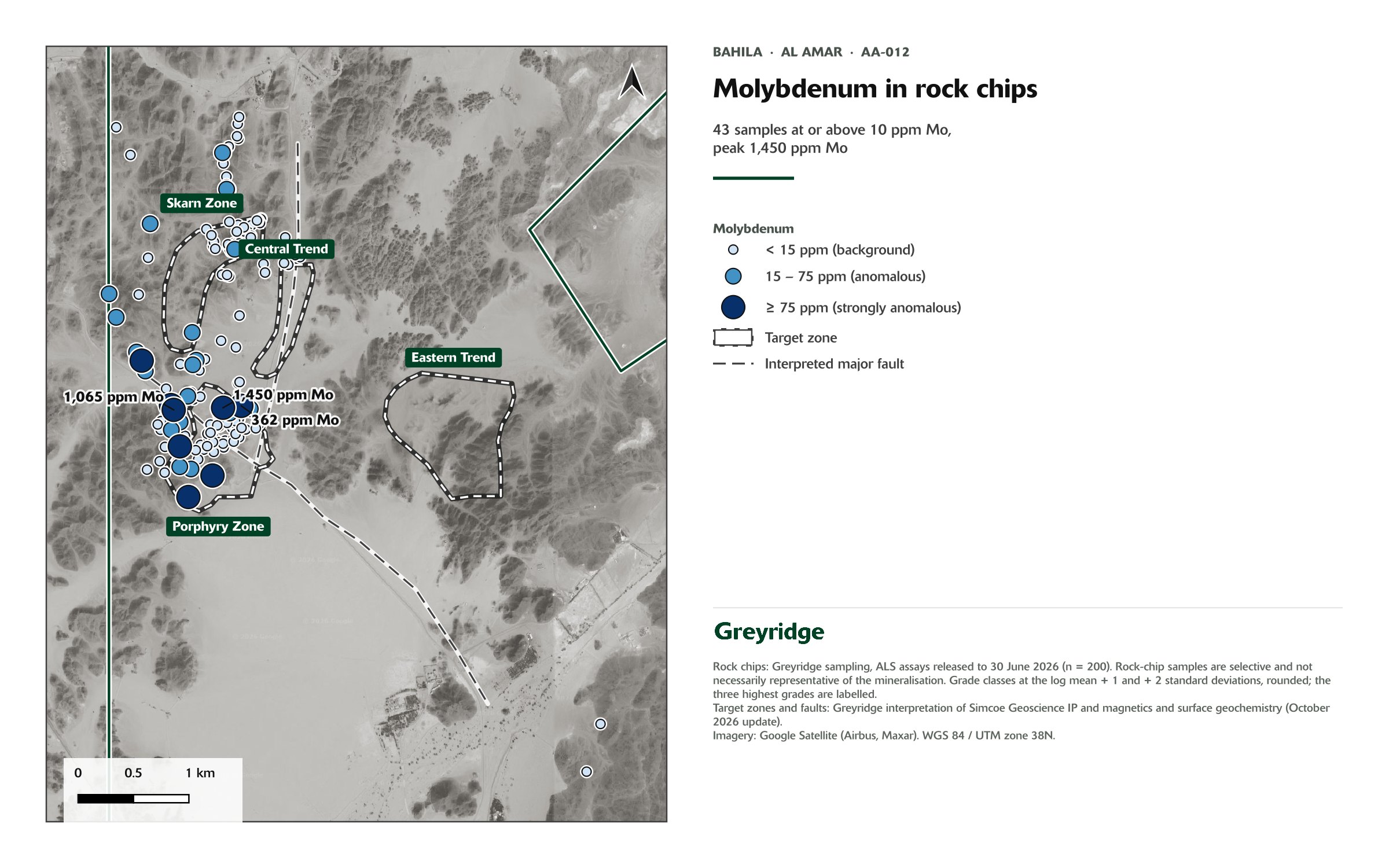
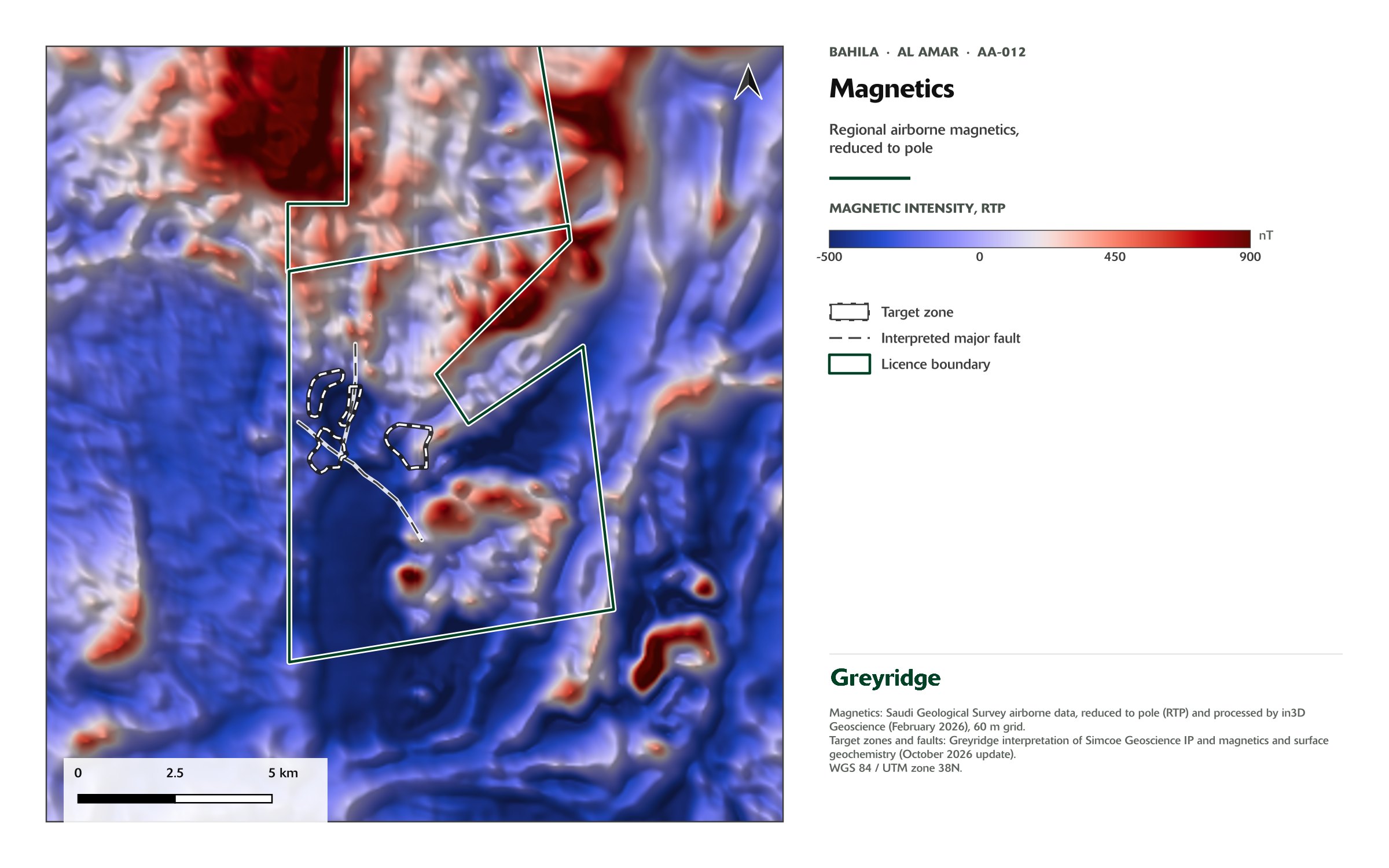
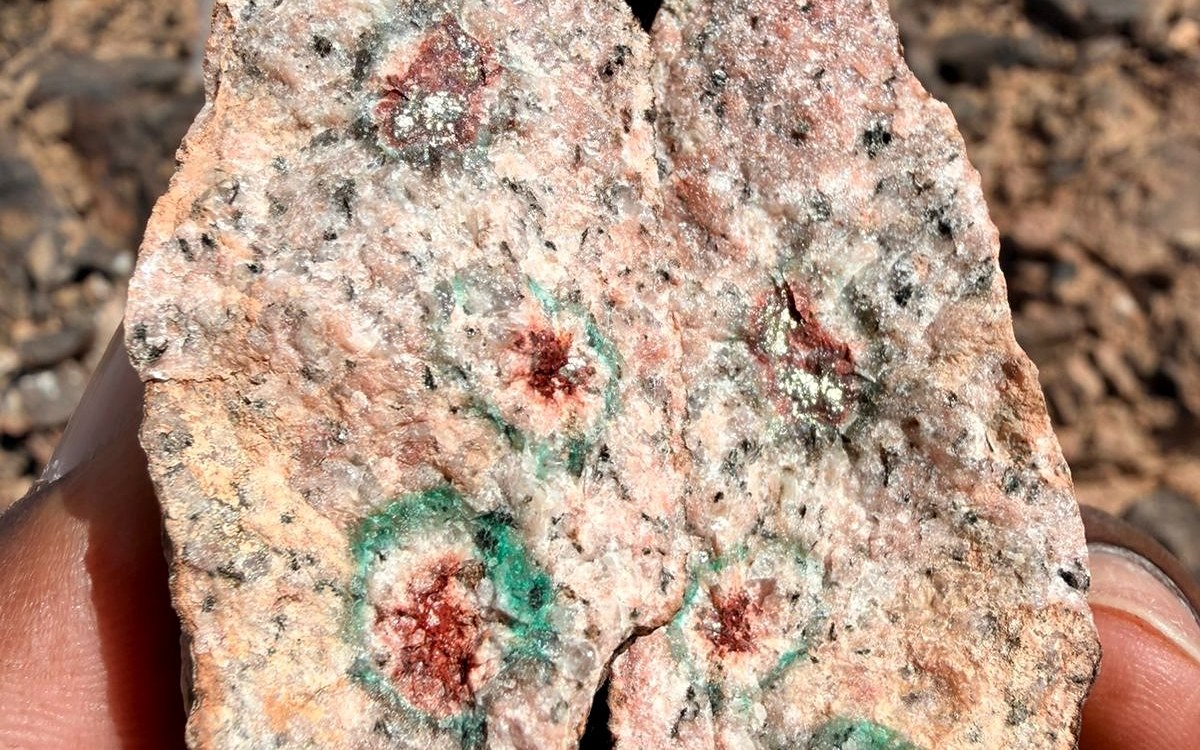
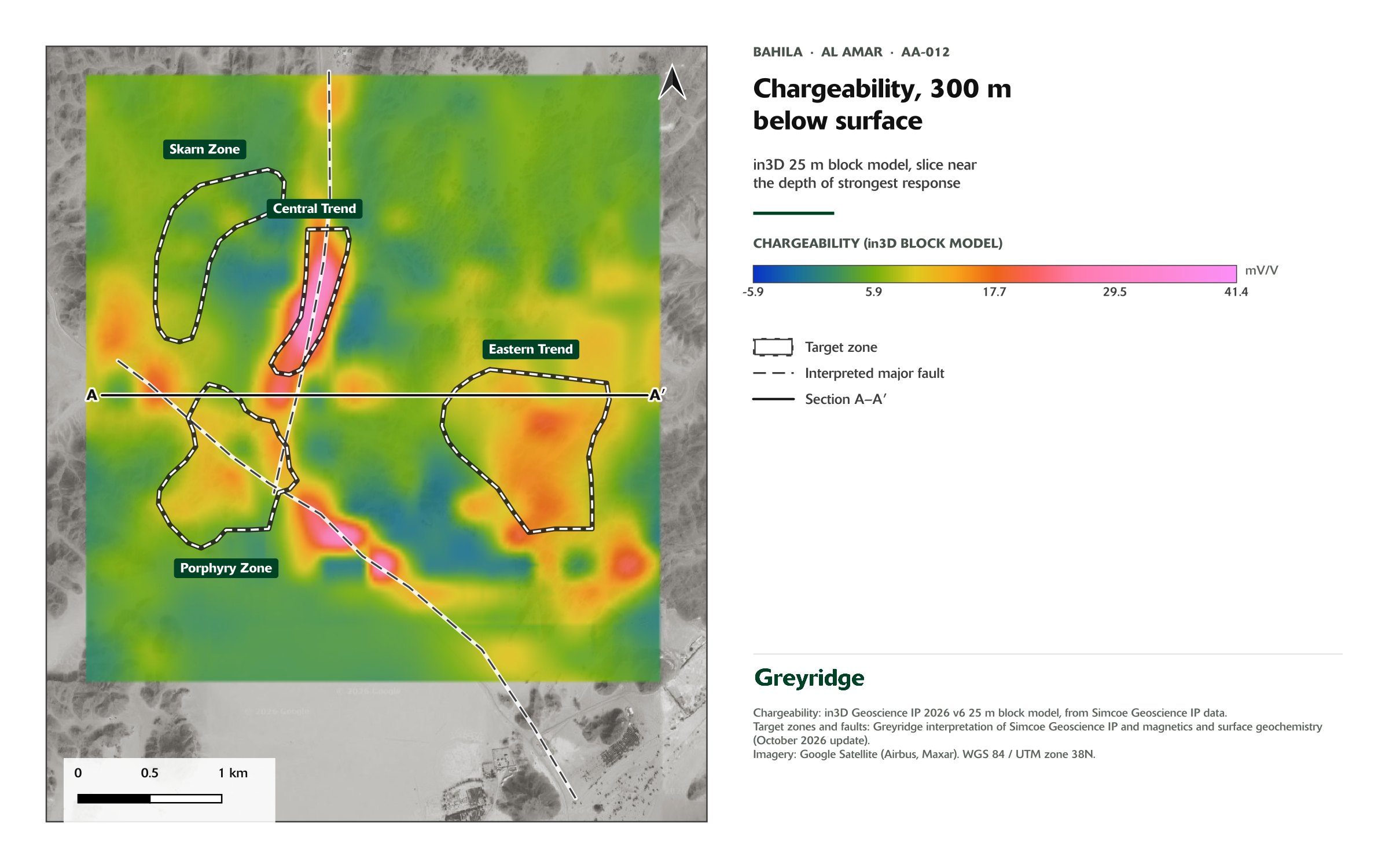
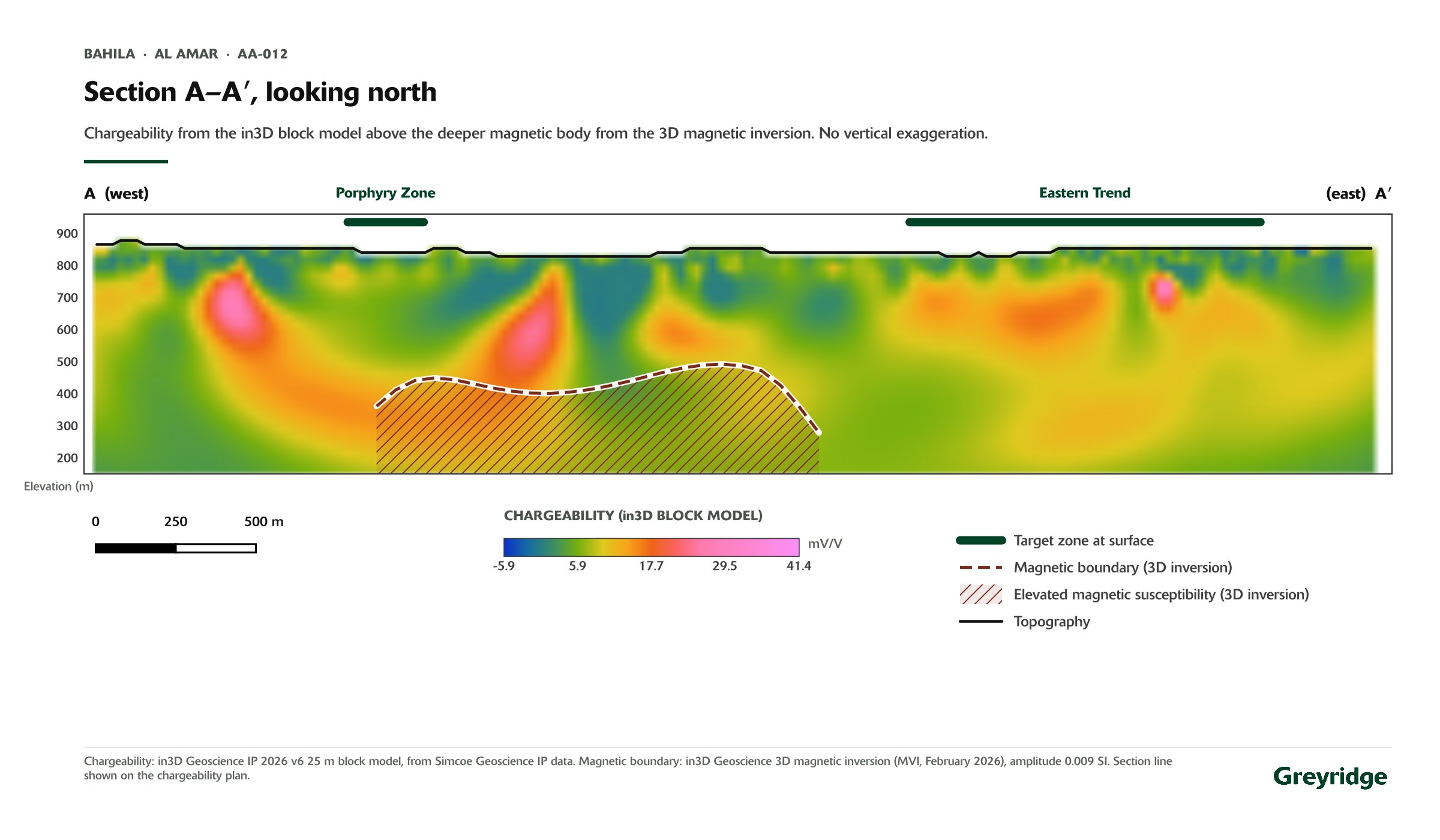
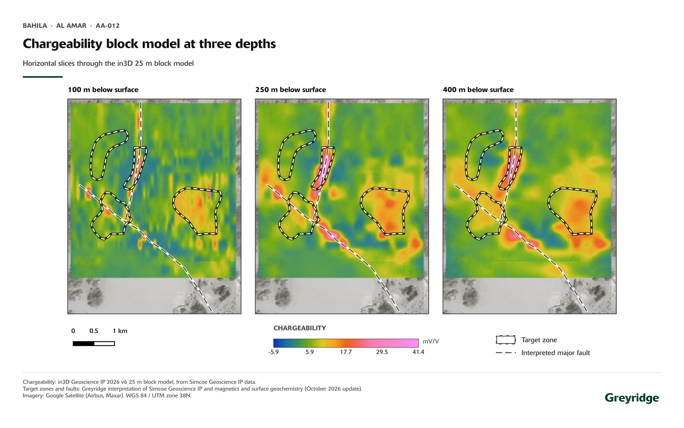
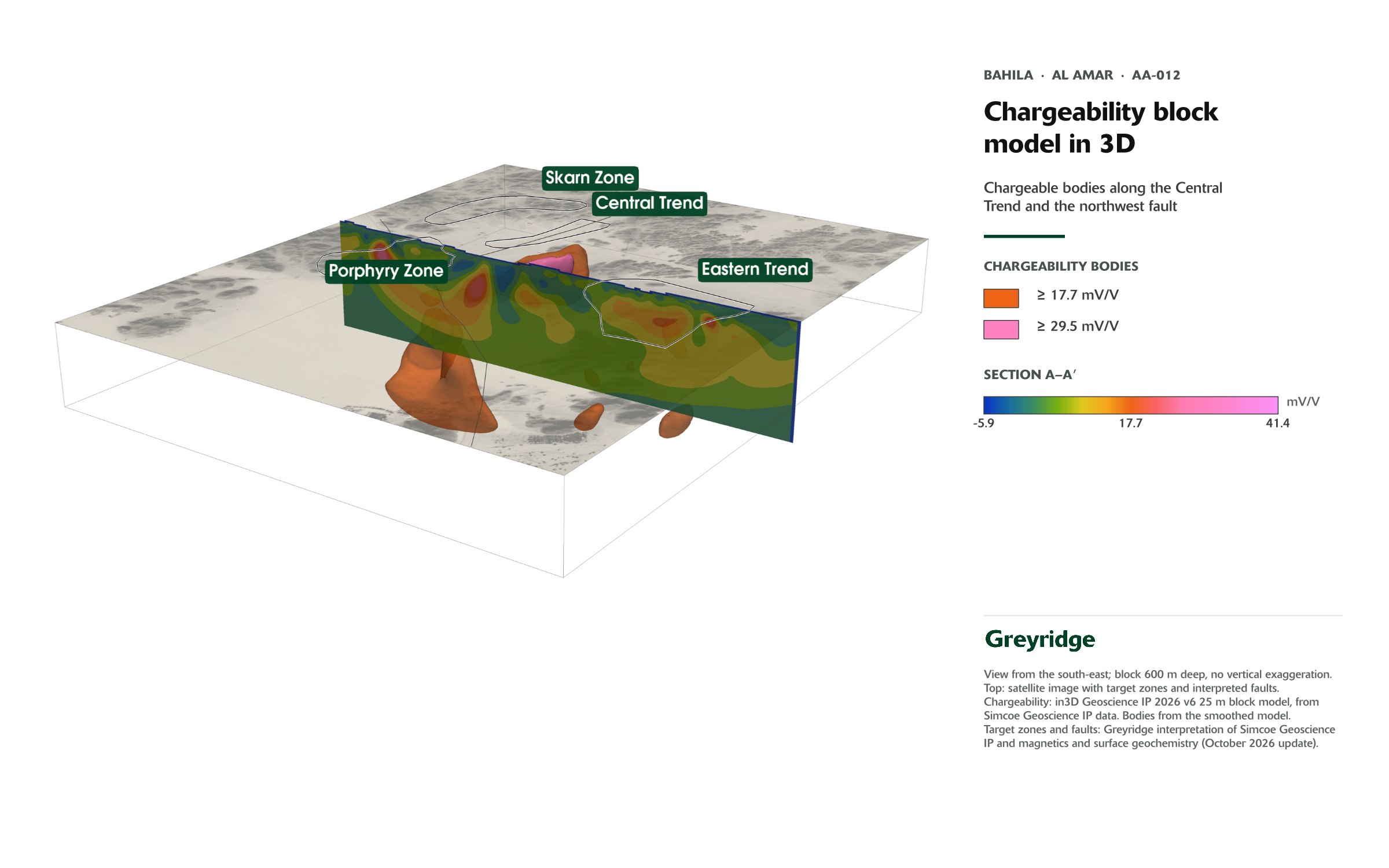
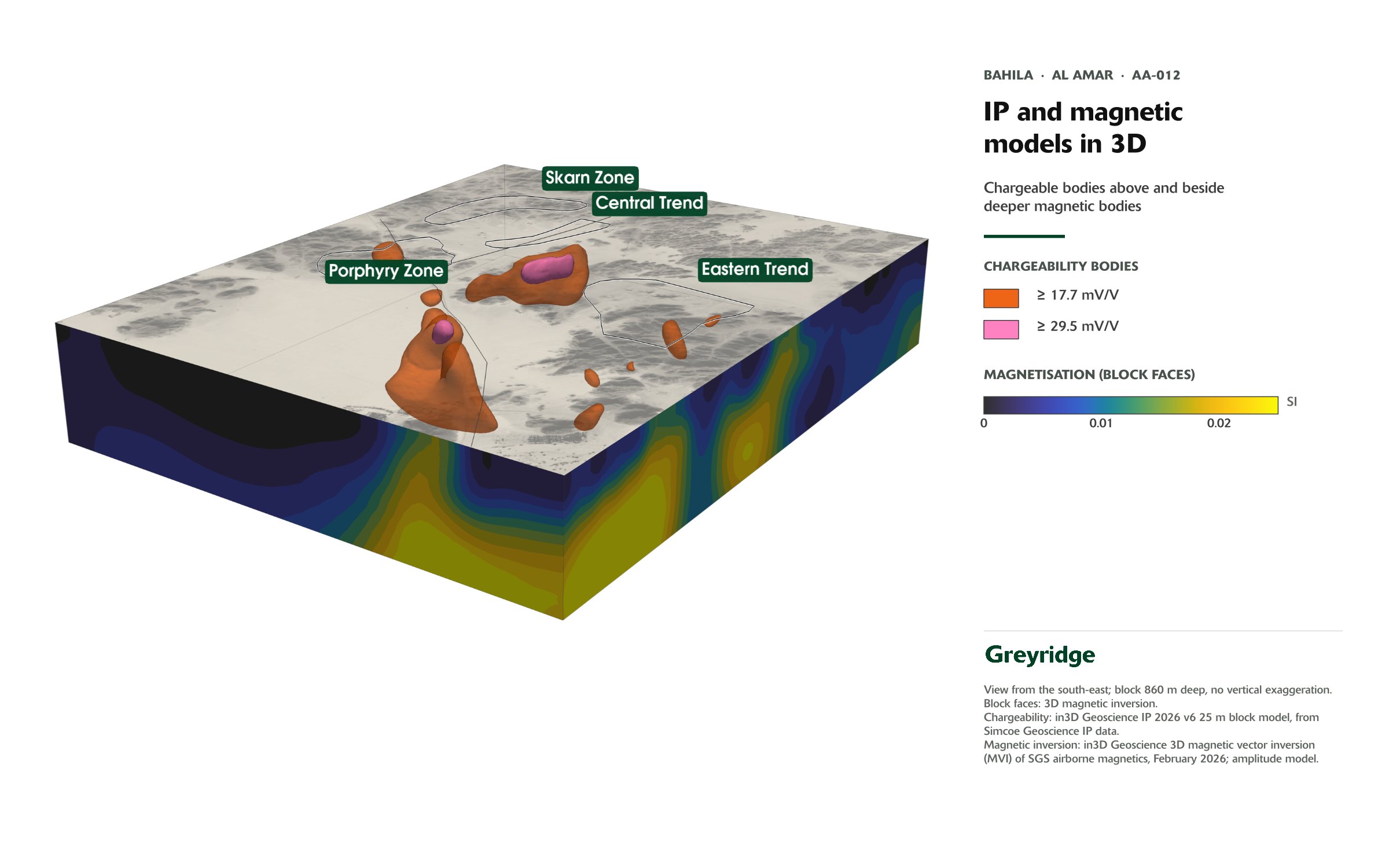
Rock chip sampling is selective in nature and is not necessarily representative of the mineralisation hosted on the licence. Chargeability and resistivity anomalies indicate the possible presence of sulphide minerals; they are not measurements of mineralisation, grade or tonnage.
Drill program
Testing the four targets
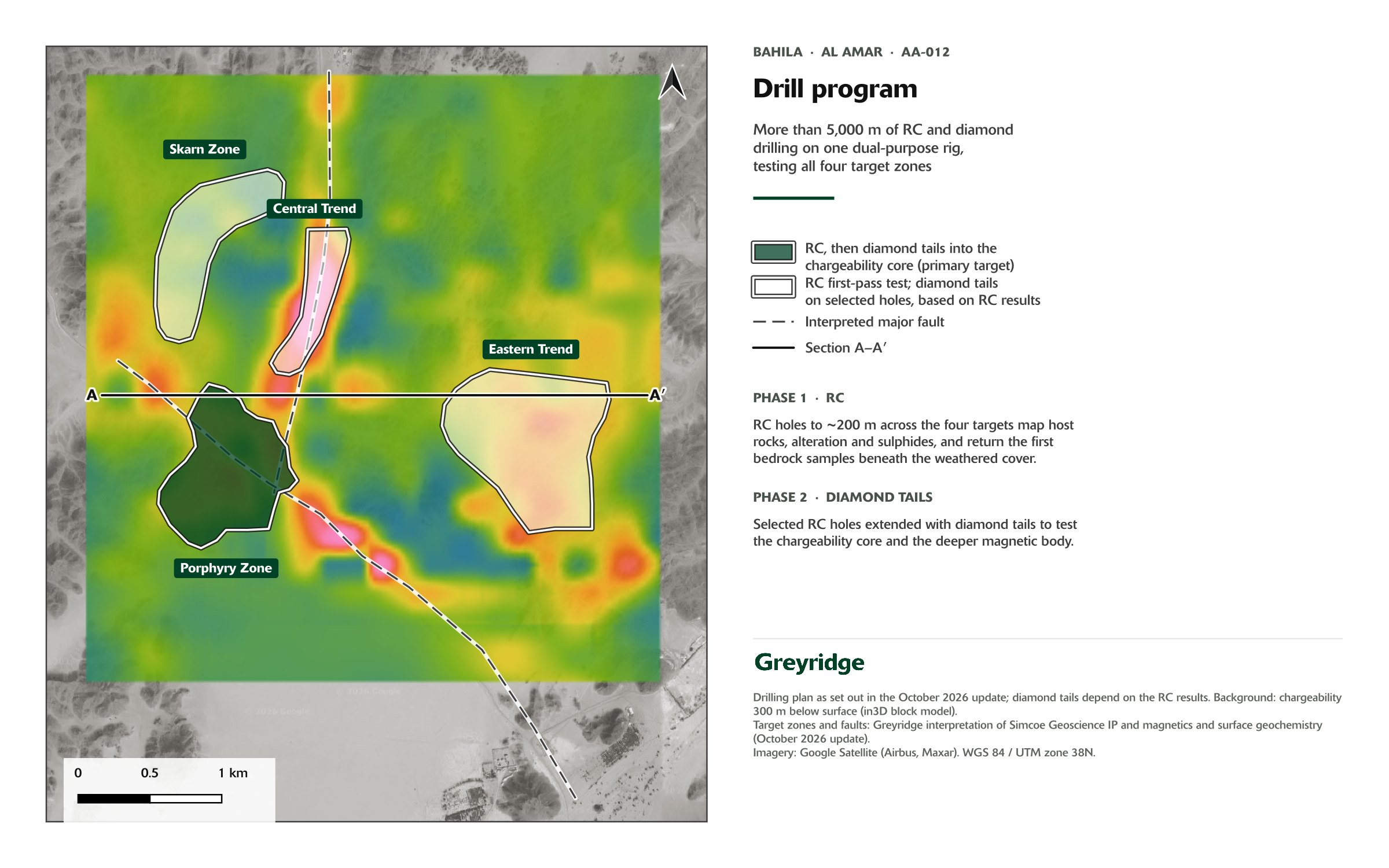
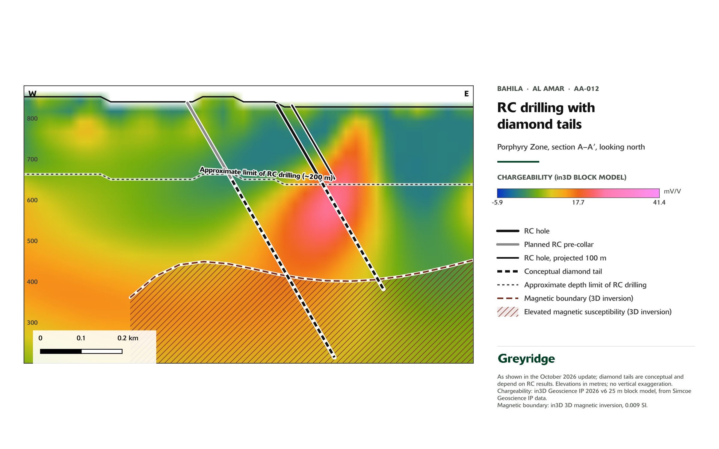
The drilling program runs in two phases using a single dual-purpose rig. Initial reverse circulation (RC) holes, drilled to approximately 200 m, will test all four targets for prospective host rocks, alteration and sulphide mineralisation. These holes will also provide the first bedrock samples from beneath the weathered and leached cover that obscures much of Bahila.
The strongest chargeability response and the deeper magnetic body lie largely beyond the reach of RC drilling. Select RC holes will be extended with diamond tails to test these targets at depth.
Porphyry Zone
Centred on a potassic-altered, sulphide-bearing intrusion and the magnetic anomaly, where magnetics, geochemistry and IP coincide.
Skarn Zone
About 1 km of garnet-diopside skarn, with copper and zinc at surface, along the northern contact of the intrusion.
Central Trend
A chargeable body along the north-south fault, coincident with a porphyritic dyke corridor and quartz-sericite-pyrite alteration.
Eastern Trend
The strongest chargeability on the property, largely beneath weathered cover outside the surface geochemical footprint.
Chargeability measures sulphide content, not copper. Chargeability and resistivity anomalies indicate the possible presence of sulphide minerals; they are not measurements of mineralisation, grade or tonnage.

Next steps
Into the ground
- Complete the RC phase across all four targets.
- Assay and interpret the RC holes, and report results.
- Diamond tails on selected holes, based on the RC results, to test the chargeable bodies and the deeper magnetic anomaly.
- Complete the ground radiometric survey and integrate radiometric and hyperspectral data into the targeting model.
- Drill program and target zones: shareholder update, October 2026. Doebrich et al. (2007). References to neighbouring deposits, including Khnaiguiyah and Ma’aden’s Al Amar mine, are provided for geological context only. Mineralisation on neighbouring properties is not necessarily indicative of mineralisation on Greyridge’s licences. See technical disclosure.
Updated 23 October 2026